
The Interstellar Mapping and Acceleration Probe (IMAP): Charting the Edges of Our Solar System
- Sharife Gacel

- Sep 25, 2025
- 3 min read

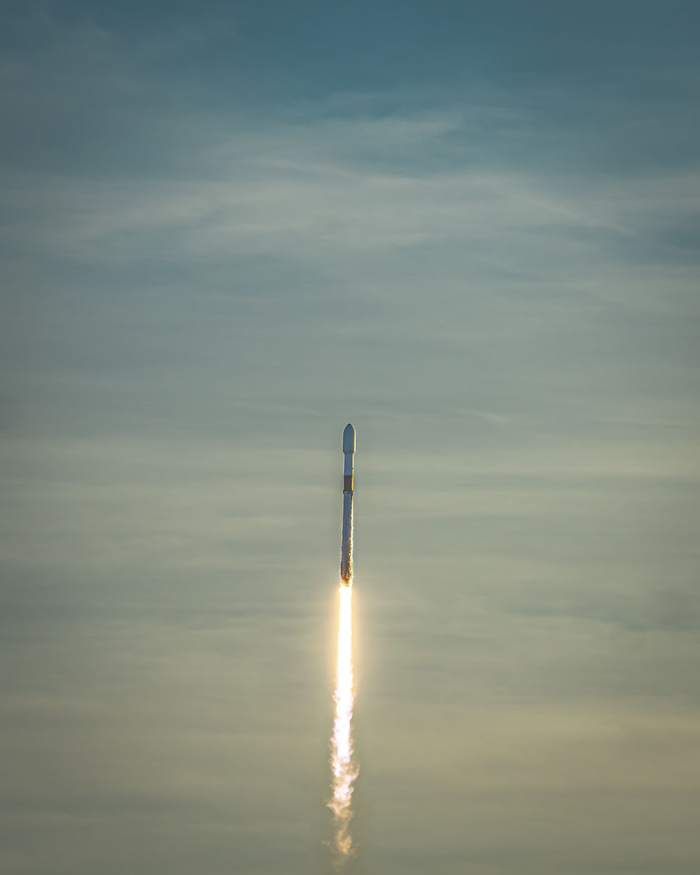
On September 24, 2025, at 7:30 a.m. EST, NASA successfully launched the Interstellar Mapping and Acceleration Probe (IMAP) aboard a Falcon 9 rocket from Launch Complex 39A at Kennedy Space Center, Florida. The mission marks a major step forward in heliophysics, expanding our understanding of the solar system’s boundary and the forces that shape it. Flying with IMAP are two companion payloads, NASA’s Carruthers Geocorona Observatory and NOAA’s Space Weather Follow-On (SWFO-L1) satellite.
IMAP: Mapping the Heliopause
IMAP will explore the outer boundary of the heliosphere, the vast bubble created by the solar wind that protects our solar system from interstellar radiation. With 27 international partners, IMAP represents a global effort to understand how our Sun interacts with the galaxy around us.
Key mission features:
Location: Positioned 1 million miles upstream from Earth at the Sun–Earth L1 Lagrange point.
Rotation: Spins every 15 seconds to capture comprehensive measurements.
Radiation Shield: Provides advance warning of radiation hazards, supporting Artemis II, Artemis III, and future human exploration of the Moon and Mars.
Science Return: Tracks the full lifecycle of solar particles, enhancing both heliophysics and space weather forecasting.
Mission scientists like to describe IMAP’s work as “one in a million, a galactic hole in one”, a nod to both its precision and its cosmic significance.
NASA’s Carruthers Geocorona Observatory
Flying alongside IMAP, the Carruthers Geocorona Observatory will continuously monitor Earth’s exosphere, the outermost layer of our atmosphere before deep space.
Highlights of this observatory:
Studies the exosphere, which may extend halfway to the Moon, though its true shape remains unknown.
Uses wide-field and narrow-field cameras to capture the entire exosphere in unprecedented detail.
Builds on Apollo 16’s pioneering exosphere observations, which revealed it extends farther than the Moon.
Investigates how even the sparse hydrogen atoms in the exosphere influence Earth’s recovery from solar flares and coronal mass ejections (CMEs).
Will launch to L1, then turn to face Earth, monitoring how solar storms interact with our planet’s upper atmosphere.
NOAA’s Space Weather Follow-On (SWFO-L1)
The SWFO-L1 satellite serves as a “space buoy” to track space weather, protecting both Earth and spacecraft. Severe solar events have already shown their impact, including over $500 million in U.S. crop losses, rerouted flights, new radiation belts forming around Earth, and the largest surge ever recorded on Mars by NASA’s Curiosity rover.
SWFO’s role:
Provides real-time space weather monitoring, ensuring continuous data flow to protect infrastructure.
Instruments include:
Coronagraph – watches the Sun for CMEs.
Solar Wind Plasma Sensor – measures density and flow of solar wind.
Magnetometer – tracks changes in the magnetic field.
Supra-Thermal Ion Sensor (STIS) – analyzes charged particles.
IMAP’s Scientific Toolkit
IMAP itself carries a suite of 10 instruments designed to measure particles and fields across the heliosphere and beyond:
Interstellar Dust Experiment (IDEX)
IMAP Magnetometer (MAG)
IMAP-Ultra
High-energy Ion Telescope (HIT)
Solar Wind Electron Instrument (SWE)
GLObal Solar Wind Structure (GLOWS)
Solar Wind and Pickup Ion (SWAPI)
IMAP-Hi
IMAP-Lo
Compact Dual Ion Composition Experiment (CoDICE)
Why L1?
The Sun–Earth Lagrange Point 1 (L1) offers a unique vantage point for all three missions. Located about a million miles from Earth, it allows spacecraft to monitor both the Sun and Earth’s response to solar activity without interference from the planet’s magnetic field.
This position maximizes observational clarity while also ensuring continuous, real-time data relay back to Earth, which is critical for both science and space weather protection.
Looking Ahead
IMAP, the Carruthers Geocorona Observatory, and NOAA’s SWFO-L1 will deploy sequentially, IMAP first, followed by SWFO, and then Carruthers. Together they continue NASA and NOAA’s tradition of cutting-edge heliophysics missions like LEXI, PUNCH, EZOE, and TRACERS.
Together, they will expand humanity’s map of the solar system, provide vital early warnings for space weather, and prepare the way for deep space exploration.

References:
Information in this article was gathered in part from NASA’s pre-launch press conference on September 21, 2025.
NASA. (2025, September 23). Interstellar Mapping and Acceleration Probe (IMAP). Science@NASA. Retrieved [date you accessed it], from https://science.nasa.gov/mission/imap/
NASA. (2025). Carruthers Geocorona Observatory. Science@NASA. Retrieved [your access date], from https://science.nasa.gov/mission/carruthers-geocorona-observatory/
NOAA NESDIS. (n.d.). SWFO-L1 Launch. Retrieved [access date], from https://www.nesdis.noaa.gov/news-events/swfo-l1-launch


Comments